EMJ Route #119 is an 881 km cross-border loop built around Saxon Switzerland, the Czech and German Ore Mountains, the Elbe Sandstones and Upper Lusatia. The accepted GPX deliberately uses different western corridors on the outbound and return legs, removing the duplicated-road problem that affected the earlier draft.
Six stages keep every riding day below the current EMJ 200 km operating ceiling. The result is a route with time for fortresses, spa towns, mining heritage, sandstone walks and historic centres rather than a sequence of long transit days. The strongest riding comes in the Erzgebirge; the strongest destination experiences are Karlovy Vary, Tisá, Görlitz and Dresden.
The route is all-paved in intent, but mountain weather and road works can change quickly. Recheck live conditions immediately before travel and treat the downloadable navigation geometry as a planning aid rather than a substitute for current road signs and closures.
Hosted view: Leaflet / OpenStreetMap basemap. Orange line = accepted route geometry; service markers correspond to the roadbook cards. Local downloaded HTML uses a clean fallback background to avoid blocked tile-server responses.
Hosted view: Leaflet / OpenStreetMap basemap. Orange line = accepted route geometry; service markers correspond to the roadbook cards. Local downloaded HTML uses a clean fallback background to avoid blocked tile-server responses.
EMJ Rider Intelligence
Dresden → Litoměřice riding brief
EMJ planning estimates are separated from live facts. Recheck road, weather and fuel information 24–48 hours before departure and again on the riding day.
Checked 04 Sep 2026
Riding Timeline
99 km / 61 miDepart 08:30–09:00Moving ≈2 h 20Elapsed ≈6–7 h with stopsTarget 15:00–16:00
Suggested rhythm: early scenic stop, coffee/fuel check before the technical middle section, 60–90 minute lunch, then one short photo/POI stop before check-in.
Rider Effort Profile
Effort 2/5Pillion: Good
Assessment considers curve density, road width, exposure, visibility, surface changes and accumulated concentration. Wet weather raises the effort by roughly one level on the shaded mountain sections.
Fuel Plan
Primary: start full at Shell Hansastraße 62, Dresden. Backup: refuel in Děčín before the final Elbe run if range is below 180 km.
Opening hours, card acceptance and fuel grades are dynamic. Never treat a published station as guaranteed without a same-day check.
Critical Sections
Königstein → Hřensko: tourist traffic, shaded bends and damp surfaces after rain.
Hřensko → Děčín: narrow Elbe-valley traffic corridor; allow for cyclists and coaches.
Děčín → Litoměřice: urban approaches and tram/rail interfaces require concentration.
Bad-weather / Closure Plan
If the sandstone/Elbe corridor is affected by weather or closure, stay on signed lower main-road corridors toward Děčín/Litoměřice. This is an unvalidated emergency planning corridor, not an EMJ GPX + ITN alternative.
Checked 04 Sep 2026. No route-specific closure is asserted here solely from absence of a warning. Check the official/live sources below 24–48 hours before departure and again on the riding day when weather warrants.
The loop leaves Dresden along the Elbe, using Pillnitz as a gentle transition from city streets into the sandstone landscape. Königstein and Hřensko define the day visually: fortress walls, table mountains and the narrow river corridor create an immediate sense of crossing from Saxony into Bohemia.
Beyond Děčín the route follows the Elbe south towards Litoměřice. The riding is accessible rather than technical, but tourist traffic around Saxon and Bohemian Switzerland can reduce average speed. The compact distance is intentional: it leaves room for a proper stop at Königstein or Hřensko and an unhurried arrival walk in Litoměřice.
Use the day to settle into the route rhythm rather than chase mileage. River-valley temperatures can differ sharply from the plateaus above, and the sandstone area is especially attractive early or late in the day.
Quiet central option a few minutes from the historic centre; the official hotel states free parking on the premises.
A practical motorcycle stop with a central location and on-site parking. Recent Booking.com feedback scores the location strongly; facilities are simpler than the more upscale stops on this route.
Small hotel about 200 m from the main square; its official site confirms secure covered bicycle storage and an online reservation form.
A straightforward centre-based choice. Recent reviews emphasise cleanliness, breakfast and convenient access; check motorcycle parking arrangements directly because the hotel specifically documents bicycle storage.
Historic-centre hotel on Sovova with free parking listed by Booking.com.
A useful alternative close to the square, with location and breakfast repeatedly highlighted. The current Booking.com listing includes free parking; confirm the exact motorcycle space with the property before arrival.
Local / regional option; check current opening hours and reservation policy.
A practical dinner option in the overnight area. Use the linked live listing for current menu, opening times and recent reviews. Official reservation form; submit at least 24 h ahead for assured processing.
Local / regional option; check current opening hours and reservation policy.
A practical dinner option in the overnight area. Use the linked live listing for current menu, opening times and recent reviews. Official table-reservation form available.
North Bohemia: look for Czech pub classics, regional cheeses and local beer. The Litoměřice area sits close to the historic Bohemian wine region; ask locally for current producers and opening times.
Activities
Litoměřice Castle
No stronger exact-destination GetYourGuide product verified in the fresh destination search
Destination activity suitable after arrival or the following morning, depending on riding pace.
Hosted view: Leaflet / OpenStreetMap basemap. Orange line = accepted route geometry; service markers correspond to the roadbook cards. Local downloaded HTML uses a clean fallback background to avoid blocked tile-server responses.
EMJ Rider Intelligence
Litoměřice → Karlovy Vary riding brief
EMJ planning estimates are separated from live facts. Recheck road, weather and fuel information 24–48 hours before departure and again on the riding day.
Checked 04 Sep 2026
Riding Timeline
164 km / 102 miDepart 08:00–08:30Moving ≈3 h 40Elapsed ≈7–8 h with stopsTarget 15:30–16:30
Suggested rhythm: early scenic stop, coffee/fuel check before the technical middle section, 60–90 minute lunch, then one short photo/POI stop before check-in.
Rider Effort Profile
Effort 3/5Pillion: Good with regular breaks
Assessment considers curve density, road width, exposure, visibility, surface changes and accumulated concentration. Wet weather raises the effort by roughly one level on the shaded mountain sections.
Fuel Plan
Primary: start full in Litoměřice. Preferred late-stage refill: Shell Jáchymovská, Karlovy Vary (published 06:00–22:00). Backup: refuel in Teplice/Litvínov before committing to the higher Ore Mountains.
Měděnec → Klínovec → Boží Dar: exposed high terrain; wind, fog and rapid temperature changes are possible.
Jáchymov descent: tighter bends and settlement traffic after a long technical section.
Bad-weather / Closure Plan
If the high Ore Mountains are unsuitable, descend early to the Czech I/13 / lower signed corridor and continue toward Karlovy Vary using current navigation. Unvalidated emergency planning corridor only.
Checked 04 Sep 2026. No route-specific closure is asserted here solely from absence of a warning. Check the official/live sources below 24–48 hours before departure and again on the riding day when weather warrants.
Stage 2 turns west across the North Bohemian basin before climbing decisively into the Krušné hory. Teplice and Litvínov are transitional anchors; after them the road character changes as the route reaches higher villages, open ridges and the mountain country around Měděnec, Klínovec and Boží Dar.
The highest section is the day’s main rider focus. Weather can shift quickly and summer weekends bring recreational traffic, so the goal is smooth progress rather than speed. Jáchymov then provides a long descent into the spa basin before the final kilometres into Karlovy Vary.
The stage is comfortably under the 200 km EMJ ceiling on the supplied GPX and balances a full mountain-riding experience with enough time to explore the colonnades after check-in.
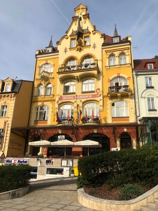
Art Nouveau hotel in the spa centre close to the Market Colonnade.
The strongest central-position choice in this set, with excellent recent scores for location and cleanliness. Central spa-zone access is excellent; confirm motorcycle parking before booking because the historic core has constrained access.
Historic hotel above the Mill Colonnade with camera-monitored private parking beside the building.
A highly rated central option with an excellent location score and free private parking reported by Booking.com. The hillside position is quieter than the busiest spa streets while remaining walkable to the colonnades.
Large historic hotel on T. G. Masaryka with spa facilities and private parking listed by Booking.com.
A full-service city option with 24-hour reception, wellness facilities and private parking. It works well for riders who want an easy evening in central Karlovy Vary; confirm the current parking fee and motorcycle access when booking.
Local / regional option; check current opening hours and reservation policy.
A practical dinner option in the overnight area. Use the linked live listing for current menu, opening times and recent reviews. Official online reservation form; advance booking is requested.
Hosted view: Leaflet / OpenStreetMap basemap. Orange line = accepted route geometry; service markers correspond to the roadbook cards. Local downloaded HTML uses a clean fallback background to avoid blocked tile-server responses.
EMJ Rider Intelligence
Karlovy Vary → Marienberg riding brief
EMJ planning estimates are separated from live facts. Recheck road, weather and fuel information 24–48 hours before departure and again on the riding day.
Checked 04 Sep 2026
Riding Timeline
191 km / 119 miDepart 08:00–08:30Moving ≈4 h 20Elapsed ≈7.5–8.5 h with stopsTarget 16:00–17:00
Suggested rhythm: early scenic stop, coffee/fuel check before the technical middle section, 60–90 minute lunch, then one short photo/POI stop before check-in.
Rider Effort Profile
Effort 4/5Pillion: Suitable for experienced pillion
Assessment considers curve density, road width, exposure, visibility, surface changes and accumulated concentration. Wet weather raises the effort by roughly one level on the shaded mountain sections.
Fuel Plan
Primary: Shell Jáchymovská, Karlovy Vary before departure (published 06:00–22:00). Backup: use a signed station in the Schwarzenberg/Annaberg corridor before the final Marienberg leg.
Opening hours, card acceptance and fuel grades are dynamic. Never treat a published station as guaranteed without a same-day check.
Critical Sections
Loket → Nejdek → Pernink: frequent direction changes and shaded forest surfaces.
Johanngeorgenstadt border sector: narrow mountain roads and changing surface character.
Schwarzenberg → Annaberg-Buchholz → Marienberg: sustained concentration late in the day with town traffic between technical sections.
Bad-weather / Closure Plan
In poor mountain weather, abandon the higher cross-border ridge line and use lower signed B-road corridors toward Annaberg-Buchholz/Marienberg. Unvalidated emergency planning corridor only.
Checked 04 Sep 2026. No route-specific closure is asserted here solely from absence of a warning. Check the official/live sources below 24–48 hours before departure and again on the riding day when weather warrants.
From Karlovy Vary the route first visits Loket, then deliberately avoids retracing the previous day by turning north-west through quiet Czech border country and crossing into the German Erzgebirge. This is the stage that fixes the earlier western-side duplication: the return uses a different geographic spine through Luby, Muldenhammer and Johanngeorgenstadt.
Schwarzenberg and Annaberg-Buchholz bring a strong mining-town identity to the middle of the day. Roads are generally paved and rewarding, but the accumulated bends and forest shade make this the most concentration-heavy stage of the loop.
Marienberg is a logical overnight because its Renaissance grid and mining heritage fit the route rather than feeling like a purely logistical stop. Arrive with enough daylight for the square and old town.
Historic central Marienberg hotel with regional restaurants and free private parking.
The most convenient town-centre base of the three. Current Booking.com information confirms free private parking and a strong location score, useful after the longer mountain stage.
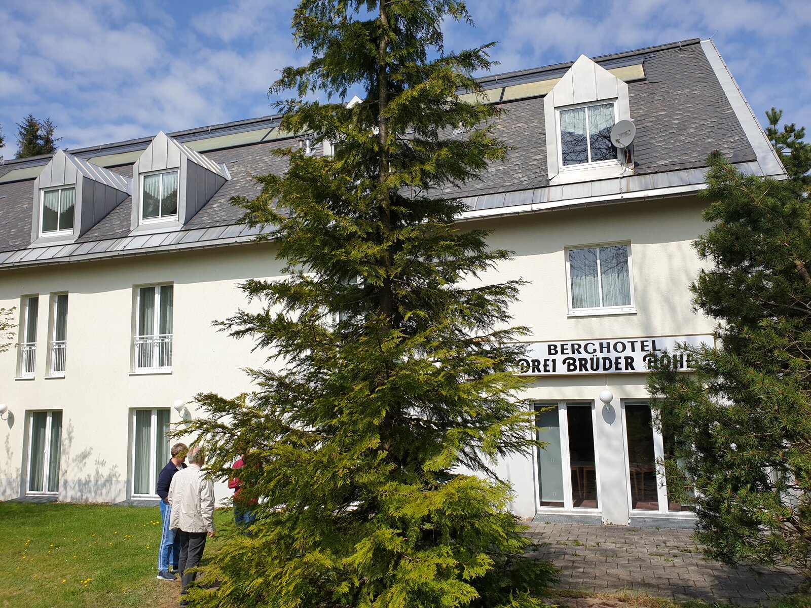
Forest-edge mountain hotel outside Marienberg with free on-site parking.
A quieter option for riders who prefer to stay out of town. Current reviews rate the location particularly well; the trade-off is that an evening walk in central Marienberg requires extra transport.
Country guesthouse and restaurant in the Marienberg area with free on-site private parking.
A quiet rural alternative with strong recent scores for staff, cleanliness and breakfast. Booking.com confirms free private parking; the more remote setting suits riders who prefer a calm overnight rather than a town-centre evening.
Mountain-inn option near Marienberg. The official site publishes day-by-day opening hours and a reservation action; check the riding-day schedule because closing times vary.
Erzgebirge: hearty Saxon mountain cooking, potato dishes and regional beer fit the colder highland climate. Try local specialities around the market rather than adding an unnecessary detour.
Activities
Museum sächsisch-böhmisches Erzgebirge Marienberg
No stronger exact-destination GetYourGuide product verified in the fresh destination search
Destination activity suitable after arrival or the following morning, depending on riding pace.
Hosted view: Leaflet / OpenStreetMap basemap. Orange line = accepted route geometry; service markers correspond to the roadbook cards. Local downloaded HTML uses a clean fallback background to avoid blocked tile-server responses.
EMJ Rider Intelligence
Marienberg → Tisá riding brief
EMJ planning estimates are separated from live facts. Recheck road, weather and fuel information 24–48 hours before departure and again on the riding day.
Checked 04 Sep 2026
Riding Timeline
103 km / 64 miDepart 08:30–09:00Moving ≈2 h 40Elapsed ≈6–7 h with stopsTarget 15:00–16:00
Suggested rhythm: early scenic stop, coffee/fuel check before the technical middle section, 60–90 minute lunch, then one short photo/POI stop before check-in.
Rider Effort Profile
Effort 3/5Pillion: Good
Assessment considers curve density, road width, exposure, visibility, surface changes and accumulated concentration. Wet weather raises the effort by roughly one level on the shaded mountain sections.
Fuel Plan
Start full in Marienberg. Preferred backup is a larger-town station before Altenberg/Tisá; do not rely on small mountain-village pumps late in the day.
Opening hours, card acceptance and fuel grades are dynamic. Never treat a published station as guaranteed without a same-day check.
Critical Sections
Seiffen → Neuhausen → Altenberg: rolling highland roads with forest shade and local tourist traffic.
Altenberg → Tisá: exposed border plateau where fog and crosswind can change quickly.
Tisá access: narrow local roads and walkers near the sandstone formations.
Bad-weather / Closure Plan
If the high eastern Erzgebirge is affected, descend to lower signed routes before the border and approach Tisá only when local conditions allow. Unvalidated emergency planning corridor only.
Checked 04 Sep 2026. No route-specific closure is asserted here solely from absence of a warning. Check the official/live sources below 24–48 hours before departure and again on the riding day when weather warrants.
A shorter stage is used deliberately between Marienberg and Tisá. The route crosses the eastern Ore Mountains through Seiffen, the Czech border forest and Altenberg before dropping towards one of the most distinctive sandstone landscapes in North Bohemia.
The compact distance gives the day a different rhythm: fewer kilometres, more time on foot. Tisá Walls are worth treating as a genuine visit rather than a photograph from the bike, and the area’s rock labyrinths are best enjoyed before the late-day crowds.
This stage also acts as a clean geographic hinge between the Ore Mountains and the Elbe Sandstones. It stays on the accepted GPX and keeps the following day below 200 km without forcing a fast-road shortcut.
Four-star forest hotel at Ostrov u Tisé; its official material documents monitored parking and an on-site restaurant.
The strongest all-round overnight choice for this nature-focused stop. Current guest feedback is very strong and the isolated setting suits an early next-morning start; reserve dinner if arriving late.
Small local hotel in Tisá with restaurant, free private parking and direct access to the sandstone landscape.
A very practical village alternative to Hotel Ostrov. Booking.com confirms free on-site private parking and strong location scores; it is particularly convenient for riders who want to stay directly in Tisá.
Small pension in the Tisá area suited to a quiet overnight.
A lower-key local alternative. Exact-property imagery has been checked, but no verified Booking.com property page was retained; confirm access, parking and current availability directly with the property.
Local / regional option; check current opening hours and reservation policy.
A practical dinner option in the overnight area. Use the linked live listing for current menu, opening times and recent reviews. Official restaurant page accepts table reservations by phone or email.
Elbe Sandstones: simple Czech mountain cooking, soups, dumplings and local beer work well after the short but scenic day. Tisá is small, so check evening kitchen hours before arrival.
Activities
Děčín: Via Ferrata Climbing Adventure in Bohemian Switzerland
2 h · 4.9/5 · 5 reviews at verification · extra travel from Tisá
Nearby bookable option starting at Shepherd’s Wall in Děčín. Best treated as a next-morning/extra-time activity rather than squeezed into a late arrival.
Hosted view: Leaflet / OpenStreetMap basemap. Orange line = accepted route geometry; service markers correspond to the roadbook cards. Local downloaded HTML uses a clean fallback background to avoid blocked tile-server responses.
EMJ Rider Intelligence
Tisá → Görlitz riding brief
EMJ planning estimates are separated from live facts. Recheck road, weather and fuel information 24–48 hours before departure and again on the riding day.
Checked 04 Sep 2026
Riding Timeline
155 km / 96 miDepart 08:00–08:30Moving ≈3 h 35Elapsed ≈7–8 h with stopsTarget 15:30–16:30
Suggested rhythm: early scenic stop, coffee/fuel check before the technical middle section, 60–90 minute lunch, then one short photo/POI stop before check-in.
Rider Effort Profile
Effort 3/5Pillion: Good
Assessment considers curve density, road width, exposure, visibility, surface changes and accumulated concentration. Wet weather raises the effort by roughly one level on the shaded mountain sections.
Fuel Plan
Start full around Tisá/Děčín area. Preferred on-route refill: ORLEN Chrastavská, Liberec (published 24 h). Backup: refuel in Zittau before the final run to Görlitz.
Opening hours, card acceptance and fuel grades are dynamic. Never treat a published station as guaranteed without a same-day check.
Critical Sections
Tisá → Česká Kamenice: forest and sandstone roads with intermittent narrow sections.
Česká Lípa → Ještěd: climbing curves, cyclists and weather exposure near the summit road.
Liberec → Oybin → Zittau: border transitions and tourist traffic in the Zittau Mountains.
Bad-weather / Closure Plan
If Ještěd or higher roads are unsuitable, bypass the summit and remain on lower signed roads through Liberec toward Zittau. Unvalidated emergency planning corridor only.
Checked 04 Sep 2026. No route-specific closure is asserted here solely from absence of a warning. Check the official/live sources below 24–48 hours before departure and again on the riding day when weather warrants.
Stage 5 leaves Tisá and arcs east through the northern Czech landscape, linking smaller towns and lake country before climbing back towards the Lusatian Mountains. Česká Kamenice, Česká Lípa and Doksy break the ride into distinct visual sections rather than one long transit.
Jablonné v Podještědí leads into the border hills and the compact sandstone resort of Oybin, followed by Zittau and the final run to Görlitz. The stage crosses between Czech and German road environments several times, so signage and speed-limit changes deserve attention.
Görlitz is one of the strongest overnight destinations on the loop. Its preserved centre and the pedestrian crossing into Poland make the arrival feel like a destination rather than simply a stop.
Riverside four-star hotel beside the city park with paid private/underground parking.
A calm arrival option with easier road access than the tightest old-town streets. Booking.com lists private parking and the location scores strongly; useful for riders who want secure parking and a short walk into the historic centre.
Modern hotel south-west of the centre with an in-house restaurant.
Excellent recent service and cleanliness scores make this a strong practical option. Booking.com notes that restaurant reservations are essential; verify parking for the motorcycle when reserving.
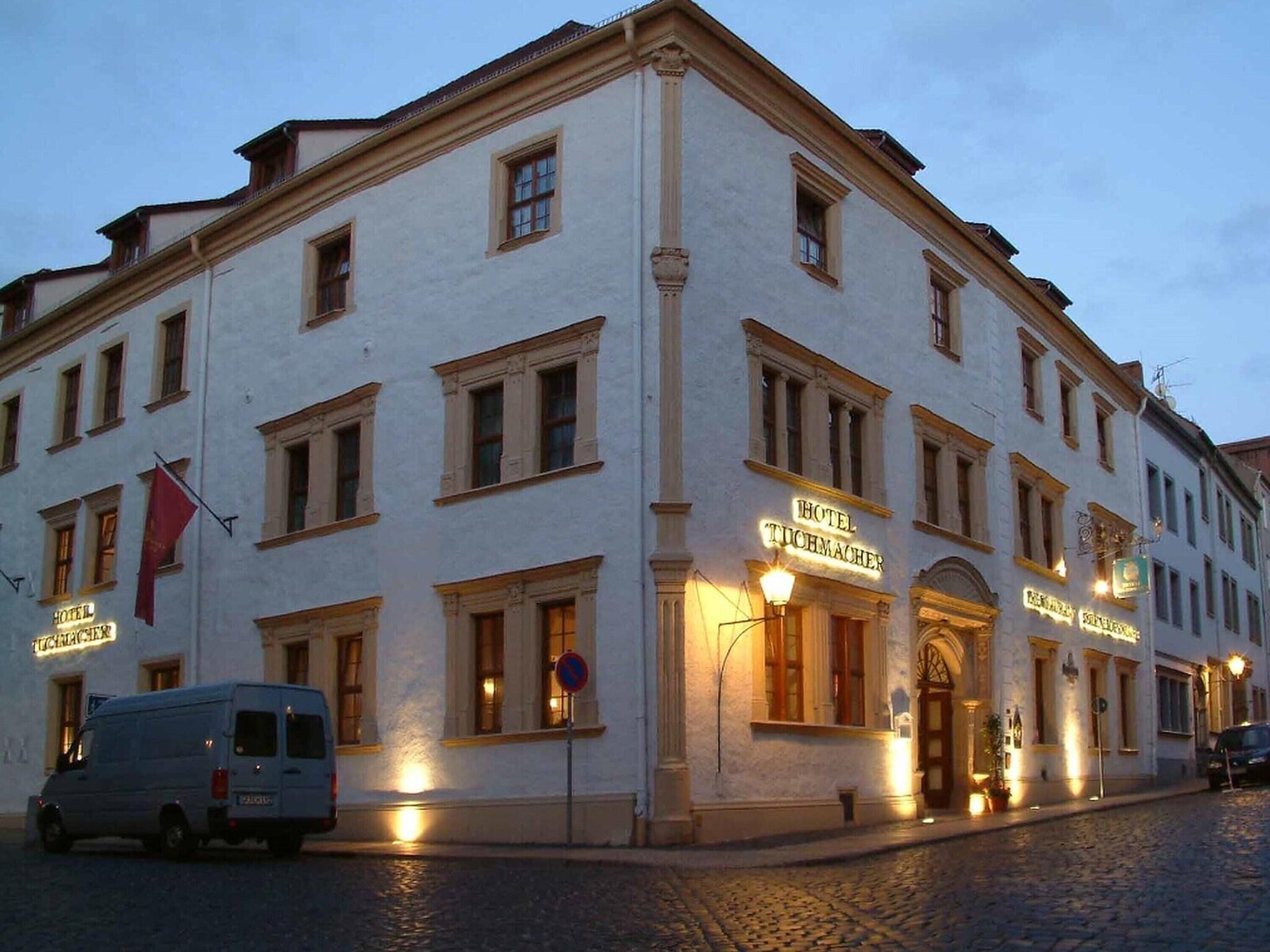
Restored Renaissance hotel in the heart of Görlitz old town.
The premium historic-centre choice, with a very strong location score and private parking available. Best for riders prioritising an atmospheric evening walk; pre-book parking because the old-town location is constrained.
Local / regional option; check current opening hours and reservation policy.
A practical dinner option in the overnight area. Use the linked live listing for current menu, opening times and recent reviews. Official restaurant accepts reservations by phone or email.
Hosted view: Leaflet / OpenStreetMap basemap. Orange line = accepted route geometry; service markers correspond to the roadbook cards. Local downloaded HTML uses a clean fallback background to avoid blocked tile-server responses.
EMJ Rider Intelligence
Görlitz → Dresden riding brief
EMJ planning estimates are separated from live facts. Recheck road, weather and fuel information 24–48 hours before departure and again on the riding day.
Checked 04 Sep 2026
Riding Timeline
169 km / 105 miDepart 08:30–09:00Moving ≈3 h 45Elapsed ≈7–8 h with stopsTarget 16:00–17:00
Suggested rhythm: early scenic stop, coffee/fuel check before the technical middle section, 60–90 minute lunch, then one short photo/POI stop before check-in.
Rider Effort Profile
Effort 2/5Pillion: Very good
Assessment considers curve density, road width, exposure, visibility, surface changes and accumulated concentration. Wet weather raises the effort by roughly one level on the shaded mountain sections.
Fuel Plan
Primary: Aral Nieskyer Straße 9, Görlitz (published 24 h) before departure. Backup: Shell Hansastraße 62, Dresden near the finish; published forecourt hours vary by day.
Opening hours, card acceptance and fuel grades are dynamic. Never treat a published station as guaranteed without a same-day check.
Critical Sections
Görlitz → Löbau → Bautzen: avoid inadvertent motorway routing; stay on the intended Upper Lusatia road spine.
Rammenau → Stolpen: village traffic, agricultural debris after rain and changing sight lines.
Moritzburg → Dresden: denser traffic and junction workload at the end of the loop.
Bad-weather / Closure Plan
If local closures affect the Westlausitz/Stolpen corridor, follow signed lower main roads toward Dresden rather than forcing a scenic detour. Unvalidated emergency planning corridor only.
Checked 04 Sep 2026. No route-specific closure is asserted here solely from absence of a warning. Check the official/live sources below 24–48 hours before departure and again on the riding day when weather warrants.
The final stage stays in Saxony and avoids the A4 as the default experience. Löbau, Bautzen and Rammenau create a cultural chain across Upper Lusatia, while Stolpen marks the transition back towards the Dresden hinterland.
Moritzburg is the final major scenic stop. The lakes and palace give the route a relaxed finish before Radebeul and the short return into Dresden. Urban traffic naturally rises near the capital, so the last hour is better ridden patiently than aggressively.
The result is a true loop with very little meaningful road repetition: Elbe and Bohemian mountain roads are used outbound, while Upper Lusatia and the palace landscape provide a distinct return corridor.
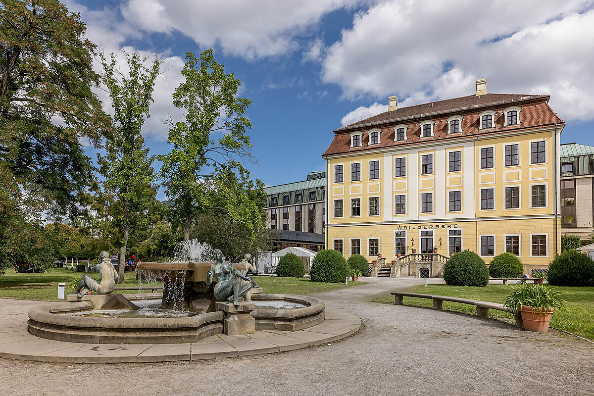
Large riverside hotel opposite the historic centre.
A comfortable finish-night option with an excellent central location and straightforward access from the north side of the Elbe. Confirm current parking tariff and motorcycle arrangements at booking.
Design hotel beside Frauenkirche with on-site parking.
A polished central choice with excellent current location and comfort scores. On-site parking is listed, but central Dresden access is busy, so confirm the garage entrance before arrival.
Modern central hotel at Postplatz with on-site parking.
A dependable city-centre finish with an exceptional location score. It suits riders who want immediate access to the Zwinger and old town; confirm parking availability because it is a high-demand central property.
Local / regional option; check current opening hours and reservation policy.
A practical dinner option in the overnight area. Use the linked live listing for current menu, opening times and recent reviews. Official reservation page; same-day reservations are handled by phone and online availability can vary.