Riding Timeline
169 km / 105 miDepart 08:30–09:00Moving ≈3 h 45Elapsed ≈6–8 h with stops
Keep the morning moving, use one meaningful mid-route stop and protect daylight for the final mountain section.
Jelenia Góra · Lower Silesia · Sudetes · Kłodzko Valley · Table Mountains · Karkonosze
EMJ Route 118 is a 495 km paved motorcycle loop through Lower Silesia, starting and finishing in Jelenia Góra. It links the Karkonosze and Izera foothills, the central Sudetes, Kłodzko Valley and the sandstone world of the Table Mountains.
The accepted GPX geometry is retained unchanged. For the reader roadbook the route is balanced into three Stages of approximately 169, 169 and 157 km, keeping each riding day within the current EMJ experience target while preserving the continuous loop.
Expect paved mountain and forest roads, spa towns, castles, fortresses and a high density of cultural stops. The route is best treated as a scenic touring itinerary rather than a fast transit ride: wet forest sections, tourist traffic and local road works can materially change pace.
Season: May–October. Mountain weather can change quickly and shaded forest roads stay damp after rain. Carry waterproof layers, clear/anti-fog vision, charging/power, tyre-repair and first-aid basics. Recheck roads, weather and park access before each Stage.
EMJ planning estimates are separated from live facts. Recheck road, weather and fuel information 24–48 hours before departure and again on the riding day.
Keep the morning moving, use one meaningful mid-route stop and protect daylight for the final mountain section.
Assessment considers curve density, road width, shaded forest sections, village traffic and accumulated concentration. Wet conditions raise effort by roughly one level.
Start full in Jelenia Góra. ORLEN Bolków at roughly the middle of the Stage is the checked backup.
Only checked Fuel Plan stops are shown in the Fuel layer. Opening hours and payment facilities remain dynamic.
If higher or minor mountain roads are affected, use the more direct corridor via Bolków and Wałbrzych toward Szczawno-Zdrój.
Unvalidated emergency planning corridor only — not a validated alternative route file.
Checked 11 Sep 2026. No route-specific closure is asserted here solely from absence of a warning. Recheck official/live sources 24–48 hours before departure and again on the riding day.
The opening Stage immediately establishes the Lower Silesian character of the loop. From Jelenia Góra the route heads west through the Karkonosze / Izera foothills, using Szklarska Poręba and Świeradów-Zdrój as scenic anchors before turning east.
The middle section links smaller Lower Silesian towns with a more open rhythm before the road tightens again around Bolków and Krzeszów. This is a good Stage for riders who prefer changing landscapes rather than sustained high-speed progress.
The finish in Szczawno-Zdrój deliberately leaves time for the spa park, dinner and an optional Książ visit.
≈ 2 km from Stage start · Spółdzielcza 40, 58-500 Jelenia Góra
Recheck current hours before departure
Google Maps≈ 125 km from Stage start · Wysokogórska 12, 59-420 Bolków
24 h published
Google MapsHistoric start city and practical pre-ride stop.
Google MapsMountain resort gateway beneath the Karkonosze.
Google MapsSpa town below the Izera Mountains.
Google MapsHistoric Lower Silesian market town.
Google MapsCastle town on the approach to the central Sudetes.
Google MapsMajor Baroque monastic complex close to the accepted route.
Google MapsArrival spa park and historic resort core.
Google MapsMajor Lower Silesian castle near the Szczawno / Wałbrzych arrival area.
Google MapsUrban gateway to Książ and the central Sudetes.
Google MapsGreen arrival area beside central Szczawno-Zdrój.
Google Maps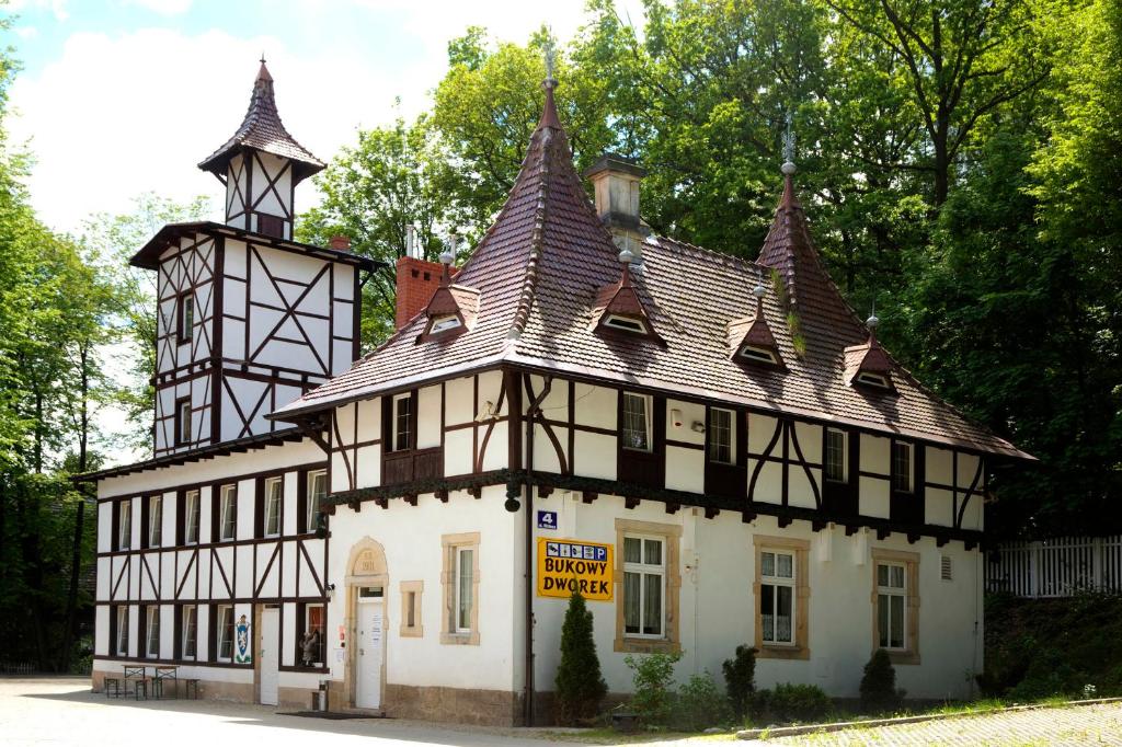
Historic 1901 property by Park Szwedzki, with restaurant and monitored/on-site parking.
Strong location and breakfast feedback; useful motorcycle base with free private parking.
Google MapsBooking.com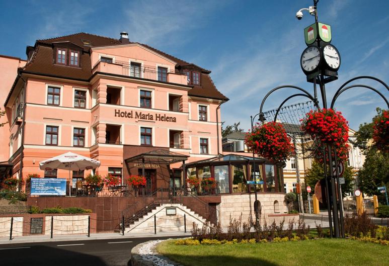
Central spa-town hotel with Polish/European restaurant and monitored hotel parking.
Excellent central location and consistently strong cleanliness/food feedback; parking is limited.
Google MapsBooking.com
Historic estate beside Park Szwedzki with restaurant/café and free parking.
Atmospheric estate setting and convenient parking; a relaxed finish after the mountain approach.
Google MapsSeasonal Polish / European cooking in the spa centre.
Google/Tripadvisor structured results ~4.1/5
Large, established restaurant with local-cuisine focus and long daily service.
Google MapsOfficial / reservation ↗Polish / European comfort food by the park.
Structured review results ~4.1/5
Popular, informal option close to the spa park and arrival hotels.
Google MapsPolish and European cuisine inside Hotel Maria Helena.
Hotel food receives strong guest feedback
Convenient central dinner option; official hotel listing publishes daily restaurant service.
Google MapsOfficial hotel booking ↗Lower Silesian / Polish cooking: look for soups, roast meats, dumplings and seasonal mountain-region ingredients. Polish cuisine ↗
Pierogi: a reliable rider-friendly regional staple with many fillings. Background ↗
Arrival activity
Walk the spa park, mineral-water area and the town’s historical path before dinner.
Map Info / bookNearby Wałbrzych landmark
One of Lower Silesia’s signature castles, practical from the Szczawno / Wałbrzych arrival area.
Map Info / bookShort evening walk
Compact viewpoint and spa-centre stop suited to an easy post-ride walk.
Map Info / bookStart among the historic spa gardens.
Historic mineral-water pump room.
Spa theatre and promenade architecture.
Compact viewpoint above the spa core.
Finish back in the historic resort centre.
EMJ planning estimates are separated from live facts. Recheck road, weather and fuel information 24–48 hours before departure and again on the riding day.
Keep the morning moving, use one meaningful mid-route stop and protect daylight for the final mountain section.
Assessment considers curve density, road width, shaded forest sections, village traffic and accumulated concentration. Wet conditions raise effort by roughly one level.
Use Shell Wałbrzych early in the Stage if needed; Circle K Kudowa-Zdrój is the checked late-Stage backup before Karłów.
Only checked Fuel Plan stops are shown in the Fuel layer. Opening hours and payment facilities remain dynamic.
In poor mountain weather, favour the lower main-road spine via Świdnica, Kłodzko and Kudowa-Zdrój before approaching Karłów.
Unvalidated emergency planning corridor only — not a validated alternative route file.
Checked 11 Sep 2026. No route-specific closure is asserted here solely from absence of a warning. Recheck official/live sources 24–48 hours before departure and again on the riding day.
Stage 2 is the most varied day of the loop, crossing from the Wałbrzych area into the Kłodzko basin. Świdnica, Dzierżoniów and Srebrna Góra give the first half a mix of cultural stops and mountain transition roads.
After Kamieniec Ząbkowicki the route swings through Kłodzko and the spa corridor of Polanica, Duszniki and Kudowa. This is the Stage where disciplined stopping matters most: there is more to see than one riding day can absorb.
The final climb to Karłów changes the scale completely, placing the rider directly below the sandstone plateaux of Stołowe Mountains National Park.
≈ 5 km from Stage start · Kolejowa 2, 58-300 Wałbrzych
24 h published
Google Maps≈ 157 km from Stage start · Słone 131A, 57-350 Kudowa-Zdrój
24 h published
Google MapsStage departure corridor into central Lower Silesia.
Google MapsHistoric city known for the UNESCO-listed Church of Peace.
Google MapsMarket town at the foot of the Owl Mountains.
Google MapsOwl Mountains gateway and useful scenic pause.
Google MapsLarge mountain fortress complex above the pass.
Google MapsHistoric town with distinctive medieval heritage.
Google MapsMonumental palace complex near the route.
Google MapsFortified historic city in the Kłodzko Valley.
Google MapsClassic spa stop with park and promenade.
Google MapsSpa town associated with Chopin and mountain-road access.
Google MapsLast major service / spa stop before the Table Mountains.
Google MapsArrival base directly below Szczeliniec Wielki.
Google MapsMountain residence in Karłów with on-site restaurant, free private parking and direct walking access to the Table Mountains.
Location is the main strength: very close to Szczeliniec access, with useful private parking.
Google MapsBooking.com
Small mountain guesthouse with garden, shared facilities and free on-site private parking.
Exceptional location and hospitality ratings; quieter, characterful alternative in Karłów.
Google MapsBooking.com
Simple mountain base in the centre of Karłów with restaurant and practical parking.
Excellent trailhead location; practical rather than luxurious, ideal for an early Szczeliniec start.
Google MapsBooking.comSimple Polish mountain food at the accommodation.
Property restaurant · Booking guest feedback
Practical dinner choice when staying at Dworek; no riding needed after check-in.
Google MapsTraditional Polish roadside / mountain dishes.
Booking.com property 8.7+ range
Very central Karłów location and a convenient post-hike dinner stop.
Google MapsPolish mountain-base restaurant.
Guesthouse / restaurant at the Szczeliniec trailhead
Casual and practical for riders staying in the village; check seasonal hours.
Google MapsMountain comfort food: Karłów is a practical place for soups, potato dishes and hearty Polish plates after the sandstone walks. Polish cuisine ↗
Pierogi: easy to find across the Kłodzko region and well suited to a riding day. Background ↗
Table Mountains classic
The signature sandstone summit walk starts directly from Karłów; allow time and check park access conditions.
Map Info / bookSandstone labyrinth
A famous rock labyrinth in Stołowe Mountains National Park; seasonal access controls may apply.
Map Info / bookWalking / viewpoints
Use the official park information for trails, closures, parking and seasonal access rules.
Map Info / bookTiny mountain village and practical arrival point.
Check current park information and trail access.
Main pedestrian access toward the plateau.
Return to the accommodation / restaurant cluster.
EMJ planning estimates are separated from live facts. Recheck road, weather and fuel information 24–48 hours before departure and again on the riding day.
Keep the morning moving, use one meaningful mid-route stop and protect daylight for the final mountain section.
Assessment considers curve density, road width, shaded forest sections, village traffic and accumulated concentration. Wet conditions raise effort by roughly one level.
Shell Wałbrzych is the checked mid-Stage primary. ORLEN Jelenia Góra is the finish-area backup before returning the bike or checking in.
Only checked Fuel Plan stops are shown in the Fuel layer. Opening hours and payment facilities remain dynamic.
If mountain roads deteriorate, use the lower corridor via Nowa Ruda, Wałbrzych and Lubawka, then continue to Jelenia Góra.
Unvalidated emergency planning corridor only — not a validated alternative route file.
Checked 11 Sep 2026. No route-specific closure is asserted here solely from absence of a warning. Recheck official/live sources 24–48 hours before departure and again on the riding day.
The final Stage starts with the sandstone landscape still close at hand, then runs through Radków and Nowa Ruda toward the Owl Mountains. Walim and Zagórze Śląskie bring mining, wartime and castle heritage into the riding day.
After the Wałbrzych arc, the route becomes more rural again through Sokołowsko, Mieroszów, Chełmsko Śląskie and Lubawka. These borderland roads are the emotional core of the loop: small towns, forested ridges and frequent changes of direction without requiring extreme riding.
The last section through Kowary, Karpacz and Sosnówka delivers the Karkonosze backdrop before the loop closes in Jelenia Góra.
≈ 67 km from Stage start · Kolejowa 2, 58-300 Wałbrzych
24 h published
Google Maps≈ 157 km from Stage start · Spółdzielcza 40, 58-500 Jelenia Góra
Recheck current hours
Google MapsTable Mountains departure base.
Google MapsSmall town below the sandstone plateau.
Google MapsHistoric mining town in the central Sudetes.
Google MapsGateway to the Owl Mountains and Riese underground complexes.
Google MapsLake and castle landscape around Grodno Castle.
Google MapsCompact spa town on the return toward Wałbrzych.
Google MapsHistoric mountain health-resort village.
Google MapsBorderland mountain town beneath the Stone Mountains.
Google MapsHistoric weaving village with preserved wooden houses.
Google MapsSudetic border town on the southern arc.
Google MapsMining heritage town below the Karkonosze.
Google MapsMajor Karkonosze resort beneath Śnieżka.
Google MapsReservoir / foothill landscape before Jelenia Góra.
Google MapsHistoric finish with arcaded market square.
Google Maps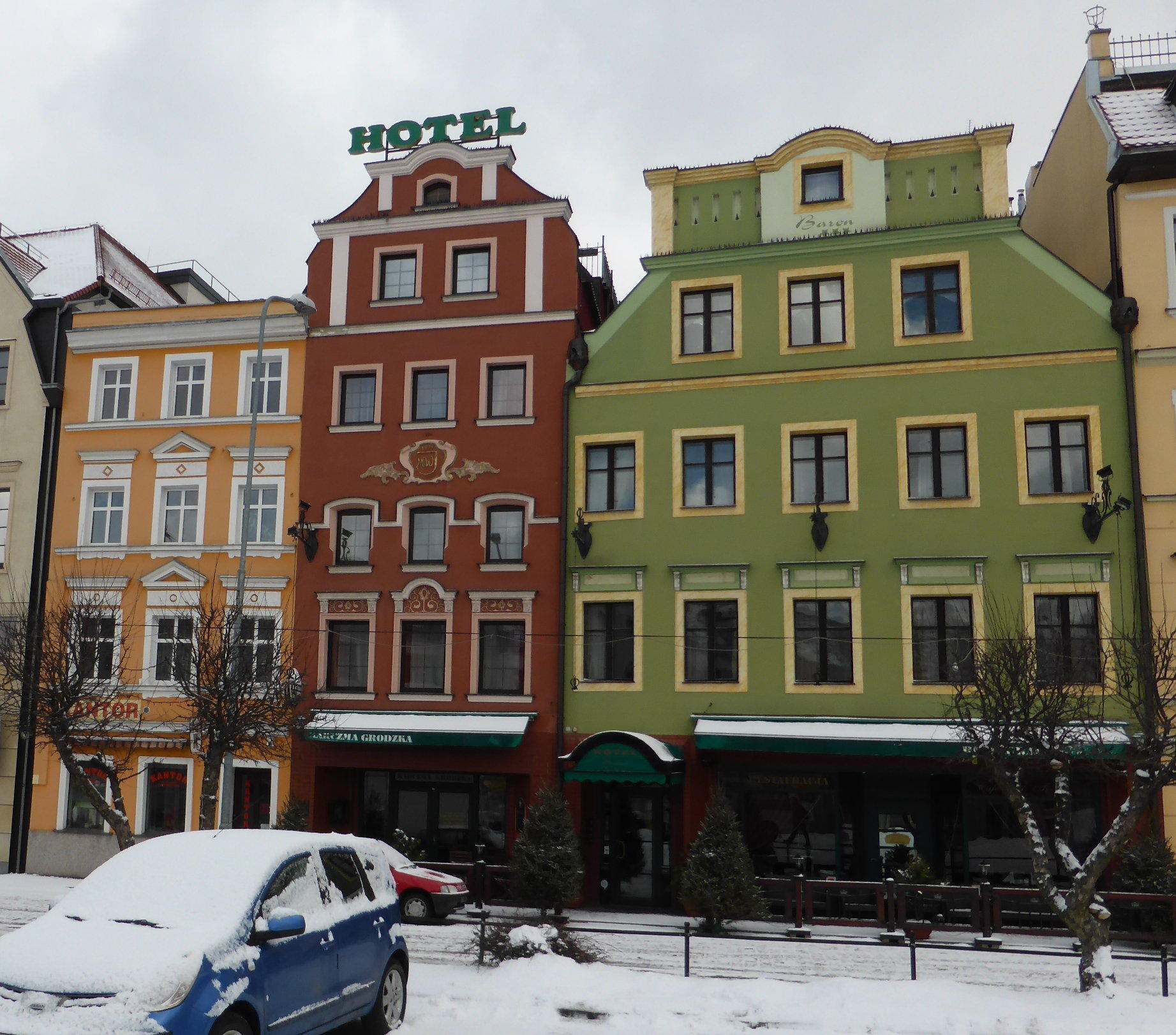
Character hotel in the Old Town, metres from the market square, with on-site restaurant.
Excellent location and breakfast; rider reviews also mention convenient/safe motorcycle parking nearby.
Google MapsBooking.com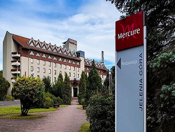
Full-service hotel south of the centre with restaurant, pool and controlled on-site outdoor parking.
Strong logistics option for riders: 24/7 controlled private parking with 120 spaces.
Google MapsBooking.com
Central city hotel close to the pedestrian core and railway station.
Convenient central location for a final-night city stay; confirm secure motorcycle parking before booking.
Google MapsPolish and international dishes at Baron Boutique Hotel.
Strong hotel dining feedback
Atmospheric Old Town option with a broad wine list and no transport needed for Baron guests.
Google MapsHotel / contact ↗European / Polish bistro directly on the market square.
Current structured result 5.0/5 (small sample)
Central, casual choice for a final-night meal in the historic core.
Google MapsItalian pizza, pasta and salads on the market square.
Current structured result ~3.8/5
Straightforward alternative to Polish cuisine with a central outdoor-city atmosphere.
Google MapsLower Silesian table: expect Polish classics with Czech and German historical influences across the region. Silesian cuisine ↗
Local beer & mountain-town cafés: the market square is the easiest place to sample the finish-city atmosphere. Beer in Poland ↗
Arrival city walk
Arcaded market square, Town Hall, gates and churches make a compact final-evening walk.
Map Info / bookRegional experience
A bookable regional option linking Karpacz and the palace landscape; check start point before booking.
Map Info / bookMountain extension
If staying an extra night, Karpacz and the Karkonosze provide the natural continuation of the route.
Map Info / bookArcaded market square and city heart.
Town Hall in the centre of the square.
Historic parish basilica.
Historic gate and chapel ensemble.
Baroque church near the edge of the old centre.